Underground mapping is the process of creating a detailed plan or map of underground spaces. These maps are used to visualize and represent what lies beneath the surface of the Earth. They are essential for various industries such as mining, construction, and even urban planning.
But did you know that there isn’t just one type of underground mapping? In fact, there are several different types, each with its own purpose and methodology. In this article, we’ll discuss the various types of underground mapping and their significance in different industries.
So let’s get started!
Ground Penetrating Radar (GPR)
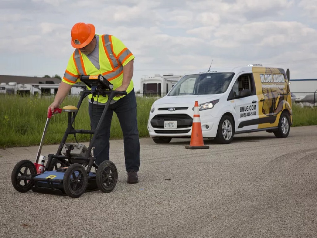
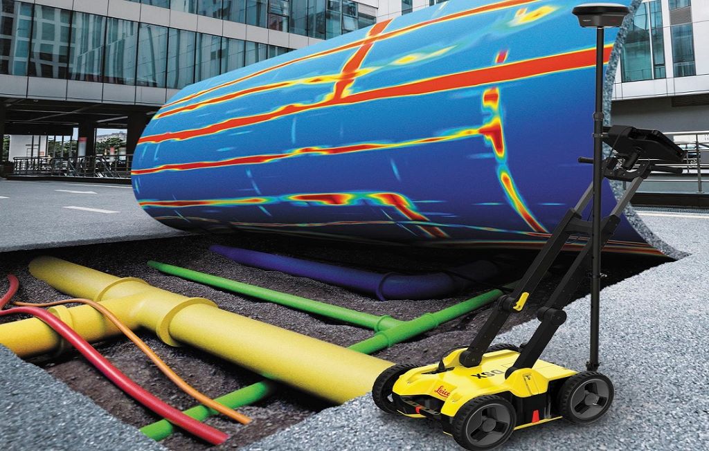
Ground Penetrating Radar (GPR) is a geophysical method that uses radar pulses to image the subsurface. It works by transmitting electromagnetic waves into the ground and then recording the reflected signals.
This type of underground mapping is commonly used to detect and map structures such as buried pipes, cables, and utilities. It can also be used to locate voids or cavities in soil or rock formations. GPR is a non-destructive method and has the advantage of being able to provide real-time data, making it a popular choice for construction and utility companies.
Electromagnetic Location (EML)
Electromagnetic Location (EML) is another popular method used for underground mapping. It’s particularly effective for locating metallic utilities and services. EML involves transmitting an electromagnetic field into the ground using a specialized transmitter. This field then interacts with underground objects, creating secondary magnetic fields which are detected by a receiver. These signals can then be used to map the location and depth of the object. But here’s a fun fact for you, did you know that there are tools available for you to use EML yourself? Yes, indeed! While professional surveyors have more sophisticated equipment, there are simplified versions available for those interested in understanding how to locate underground utilities yourself. As fascinating as it is, note that it’s always safer to hire professionals when dealing with underground mapping.
Electrical Resistivity Imaging (ERI)
Electrical resistivity imaging (ERI) is a geophysical method that measures the resistance of electrical current in the subsurface. It works by injecting an electric current into the ground and measuring how it travels through different materials. This data can then be used to create a 2D or 3D image of the subsurface.
ERI is commonly used for mapping bedrock, water tables, and other geological structures. It can also be used to locate buried objects such as tanks, drums, or utilities. ERI is a non-destructive method and has the advantage of being able to provide detailed images with high resolution.
LiDAR
LiDAR (Light Detection and Ranging) is a remote sensing method that uses lasers to measure distances. It works by emitting laser pulses from an aircraft or satellite and then recording the reflected signals.
This type of underground mapping is typically used for creating accurate terrain models, identifying elevation changes, and detecting geological features such as faults or fractures. LiDAR can also be used to map caves and other underground structures. It is a highly precise method with the ability to generate high-resolution 3D images.

Magnetic Resonance Sounding (MRS)
Magnetic Resonance Sounding (MRS) is a geophysical method that uses electromagnetic waves to measure subsurface characteristics. It works by transmitting radio frequency signals into the ground and then measuring how they are absorbed and reflected by different materials.
MRS is commonly used for mapping underground water resources, detecting buried objects, and identifying geological structures. It is a non-destructive method that can provide valuable information about the subsurface without the need for drilling or excavation.
Electromagnetic Induction (EMI)
Electromagnetic Induction (EMI) is a geophysical method that measures the electrical conductivity of the subsurface. It works by inducing an electric current into the ground and then measuring how it is affected by different materials.
EMI is commonly used for mapping soil moisture, identifying buried objects or structures, and locating underground utilities. It has the advantage of being able to cover large areas quickly and can provide real-time data.
Underground mapping is a crucial process for various industries, and the different types of underground mapping serve different purposes. GPR is commonly used by construction and utility companies for subsurface imaging. ERI is invaluable for geological mapping and understanding underground formations. LiDAR provides precise measurements, while MRS aids in water resource management. EMI excels in fast data collection. Together, these methods offer a comprehensive understanding of what lies beneath the surface. How Buildings Stay Cool in a Heatwave.
So the next time you see an underground map, you’ll know that it was created using one or more of these mapping techniques. And with advancing technology and new innovations, there’s no telling what other types of underground mapping may emerge in the future.
FAQs
What industries use underground mapping?
Underground mapping is essential for industries such as mining, construction, urban planning, and environmental management.
Is underground mapping destructive?
Most types of underground mapping are non-destructive, meaning they don’t require drilling or excavation. However, some methods may involve minor disturbances to the ground surface.
Can underground mapping detect buried objects?
Yes, various types of underground mapping can detect buried objects such as pipes, utilities, and even abandoned structures.
Is underground mapping expensive?
The cost of underground mapping can vary depending on the method used, the size of the area being mapped, and other factors. However, advancements in technology have made it more affordable in recent years.
Can underground mapping be done anywhere?
Most types of underground mapping can be done in any location, as long as the necessary equipment and expertise are available.
Conclusion
Underground mapping plays a crucial role in various industries for its ability to provide valuable information about the subsurface. With advancements in technology, we can expect to see even more accurate and efficient methods of underground mapping emerge in the future. So next time you encounter an underground map, remember that it was created using one or more of these types of mapping techniques!